By Mario Pinti
Coming across Melbourne’s western plains for the first time, the early pastoralists would have been salivating. Gently undulating, sparsely timbered grasslands as far as the eye can see.
From Footscray to Rockbank, Williamstown to Werribee, pastoralists quickly took possession of what land they could for sheep and cattle.
Settler accounts from after 1835 tell of the sudden and fundamental changes colonisation had on the landscape and the lives of the local inhabitants.
For Indigenous people the pastoral industry not only meant dispossession and, sometimes, violence, but increasing hunger as the wildlife and plants on which they relied for food and fibre gradually disappeared.
As the colonial economy evolved, so did land use. After the farms came factories, quarries and ever-expanding urban settlements.
Today, but for a few pockets of protected grassland mostly encircled by freeways and industry, it’s almost impossible to see anything of what the original inhabitants enjoyed and settlers took away.
Almost.
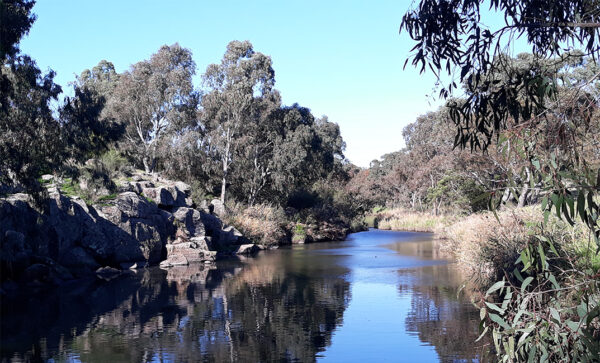
Go to the three main waterways of the west: Kororoit Creek, the Maribyrnong River and the Werribee River, and it is possible to get a sense of how it would have been before colonisation. Vestiges of the past remain along their grassy banks, rocky escarpments, ravines and incised valleys.
Of course, these waterways also suffered from unthinking development, and then neglect. After logging took most of the ancient trees and livestock eroded the banks, they were treated as drains for industrial waste and graveyards for incinerated cars.
Fortunately for these streams, the worst may be over. For the last three decades in particular, many community environment groups, supported by government agencies, and some private businesses, have worked tirelessly to save remnant vegetation and wildlife, and to replant the lost trees, shrubs and flowering grasses.
“We’re doing for the local flora and fauna what the government would like to do for people: we’re building homes,” is how Richard Tregear, assistant secretary of Friends of Kororoit Creek (FOKC), sums up his organisation’s twenty-plus years of work.
“Our plan has been to create a native habitat corridor both as a home and food store for insects and birds to propagate and move up and down the creek.”
FOKC have taken responsibility for several kilometres of waterway where it runs through Sunshine. Several sign posted zones that have been rejuvenated are colloquially referred to as the Bug Rug, Lizard Lounge and Stepping Stones.
And then there is Walan-Walen. Of it, Richard says: “We want to educate people about the local Indigenous tribes. Local Indigenous artists have carved animals and birds on rocks representing each of the Koori seasons. There’s a children’s playground too that, instead of swings and slides, has flowers, logs, rocks and pathways to explore.”
At the Bug Rug photos document an astonishing number of birds that have returned or are sufficiently thriving to make this corridor of native vegetation their home.
“At Bug Rug we’ve built frog bogs, too,” says Richard. “If you build a home for them the frogs will come. Plant flowers and the butterflies will come. Plant trees and the birds will come.”
“We’re hoping birds and animals can move in an unbroken corridor from Williamstown to Sunbury. Which is what it was for the Indigenous people.”
Indeed, it was. Evidence of at least 40,000 years of Indigenous occupation exists along the length of the waterway. The creek and its banks were a reliable food source. The escarpments provided shelter and space for semi-permanent camps. It also served as a significant meeting place, the creek being a natural border between several clans.
While industry has now largely left the creek’s environs, redfin and eels can be found in its waters, but pollutants and storm water surges remain a problem, says Gerard Morel, Waterways and Land Officer with Melbourne Water.
“Older suburbs like Sunshine have drains sending storm water straight into the creek whereas newer suburbs like Caroline Springs have wetlands treating the water first before sending it into the creek at a more naturally occurring rate.”
Nevertheless, as a corridor for native life the creek’s restoration is succeeding, says Gerard. Around Albion an echidna has been seen. Where Sunshine meets Brooklyn, a wallaby has been spotted. In both instances they have clearly used the creek to explore and wander. Regular sightings of the native water rat, the cute one, not the one in your roof, suggests the same.
“We just need lots of habitat and food options to encourage this,” he says. “The early settlers and developers cleared the creek almost entirely of its vegetation and we’re planting it back.”
Today an almost unbroken 20 plus kilometre walking and cycling path follows this two-million-year green artery running right through the heart of the west.
From Albanvale to Brooklyn information boards detail the Aboriginal life that flourished, important archaeological finds and community stories such as the ‘Big Hole’ in Albion, Sunshine’s first public pool before pollution shut it down.
Down Altona North way the equally astonishing reclamation work undertaken by the Friends of Lower Kororoit Creek greets you with thickly wooded banks and slopes, while the large sculptures dotting the way offer interpretation of place.
Along every stretch of the creek are places where you can forget where you are, where nothing of the surrounding suburbs is seen. Where the din of road traffic gives way to the sounds of birdsong and water rapids filling large, peaceful, water holes.
Seeing our waterways gradually return to health really is something to salivate over.
Starting points
Visit alltrails.com and search for:
Kororoit Creek Trail
Maribyrnong River Trail
Werribee River walk


