By Mario Pinti
Here on our doorstep at the north western end of Port Phillip Bay, a 20km plus stretch of coastline crescents its way from Williamstown’s Point Gellibrand down to Point Cook. For years Westies and visitors have enjoyed access to much of it via Hobsons Bay Coastal Trail. The shared path traverses everything from swimming beaches, cafes and public artworks to marine parks, heritage sites, internationally recognised wetlands and places to spoil a dog silly.
It is a coastline as diverse as the West itself.
However, until this year connection and proximity to the shoreline when heading south pretty much ended at Skeleton Creek, well short of Point Cook. Thereafter the journey could only continue through the streets of the nearby burbs. Nothing wrong with those fine neighbourhoods and the good people who live there, of course, but having to turn away from blue water and sea eagles to vehicular traffic is definitely a letdown. Especially when in the near distance the shoreline and trees of Point Cook can be seen. So tantalisingly close yet an undesirable four kilometre inland road trip away.
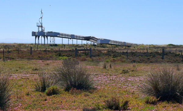
Now an elevated boardwalk, a mere 400 metres in length, connects Hobsons Bay Trail with the Wyndham Bay Trail keeping visitors off-road all the way to the historical Point Cook Homestead. Talk about an excellent piece of public infrastructure efficiently connecting people, places and nature. After the boardwalk, heading south east along the well-signed route, there are information boards, toilets, drinking fountains, lagoons and shady rest spots. And the always-interesting wetlands.
This summer why not check it out and see where it takes you. Try the Twin Peaks challenge – you read it first here – and bag the two highest points along the way: The 100 Steps of Federation at Truganina Park and the Cheetham Wetlands Observation Tower just before Point Cook Coastal Park on Bunurong Country. Promise, you won’t run out of puff getting to the top.
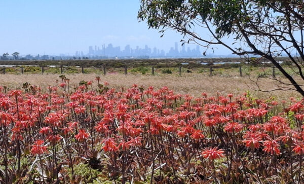
About five kilometres apart, the former is a rehabilitated rubbish tip proving that sometimes something good can come from an environmental hazard. The latter is a monument dedicated to the migrants, both birds and people who’ve made the surrounding district their home. Both reward the climber with panoramic views of the city skyline, the hills that fringe Melbourne and the wider bay.
Point Gellibrand to Point Cook, the Great Western Crescent. You first read that here, too.


